
Trace a Byron Township Street
A Byron Township street search works best as an address trail. The first record identifies the parcel and current owner-centered data. The next record tests the parcel’s position and jurisdiction. Recorded instruments then connect the parcel to a dated ownership trail. This sequence avoids treating a mailing address, a voter result, or a street label as proof that every person at an address is known.
- Enter the known address in the Byron Township assessor search or Kent Public Viewer. Write down the situs address, owner name, parcel number, and legal-description clue.
- Use the GIS parcel shape to pan along the Byron Township road. Select each parcel separately and retain the governmental-unit and school-district fields.
- Use the current owner name and parcel details in the Kent deed index. Compare the legal description before treating a document as part of the same address trail.
- For a likely individual, MVIC is a name-and-birth-month/year match, not a road roster. A formal voter-file request has separate geography and public-field rules.
- For a past household lead, consult address-first Bresser or Polk material through the Library of Michigan directory guide. It is a dated directory snapshot, not continuous occupancy evidence.
That order keeps the Byron Township street directory tied to the durable parcel key before a name or an old address label sends the search in the wrong direction.
Search Byron Township Addresses in BSA
The official Byron Township assessor page directs property research to BSA Online. Owner-name, address-oriented, and parcel-number modes provide a practical entry point. Start with an address when one is known, then verify the returned parcel number and situs. For the same-name problem, the parcel number is stronger than a name alone.
| BSA field | Input or result | How it helps a street search |
|---|---|---|
| Parcel Number | Optional text | Cross-check the county PPN or local parcel format. |
| Owner Name | Optional text | Try surname and initial variations, then match the situs. |
| Address / Property Address | Optional text | Find a street-number and road result before following a parcel. |
| Search and reset | Action controls | Run or clear a query; current vendor labels can change. |
| Parcel result | Result card | Review owner, address, value, exemption, building, and land context. |
The BSA Online property-search screen is the township’s reference copy of basic property information.
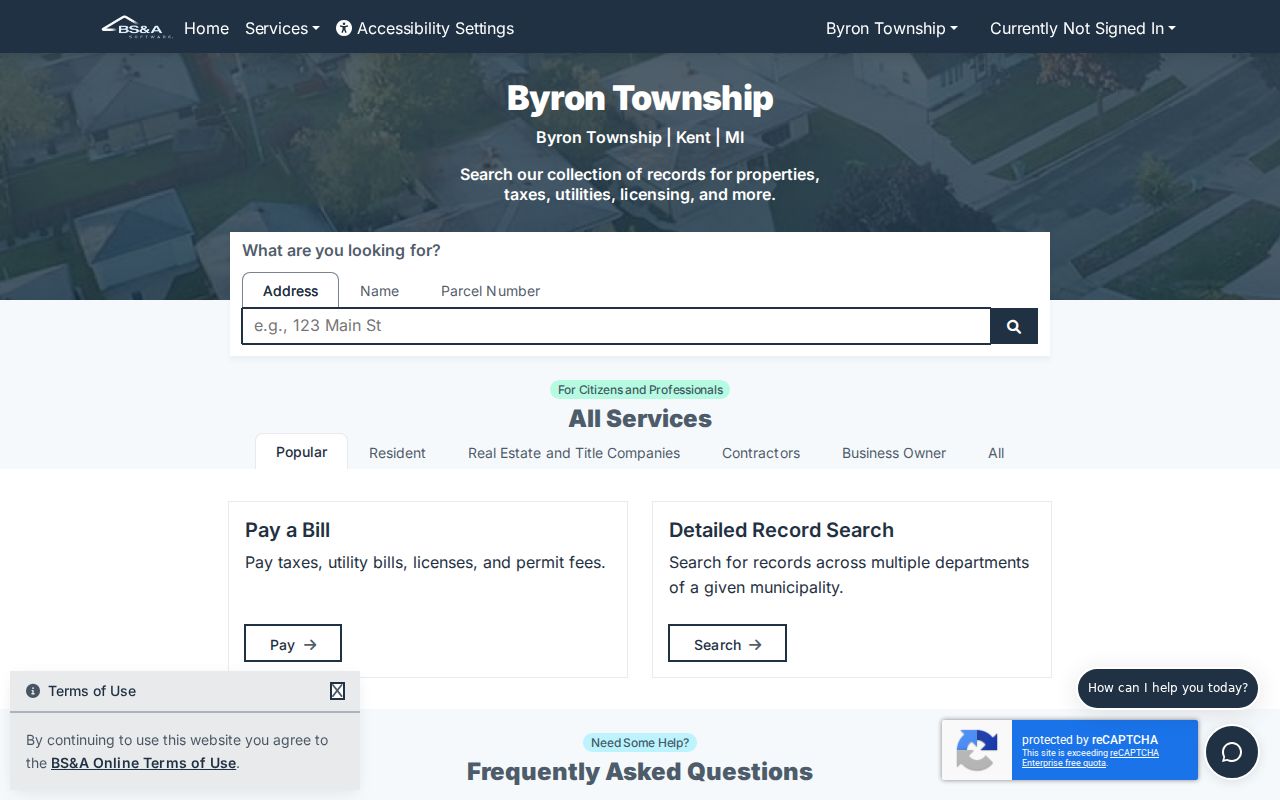
Values and Principal Residence Exemption information were accurate as of transfer to the web, while building and land data come from the current production database for the upcoming assessment year and may change. A principal-residence status is not proof of every current occupant.
Note: The documented BSA interface supports owner, address, and parcel research, but a current ZIP filter, export control, and every live label were not verified.
Browse Byron Township Streets in GIS
Kent County Public Viewer starts with “Search for an Address.” After the map centers on a match, select the parcel polygon and pan through the Byron Township street segment. Parcel geometry helps separate adjacent lots, condominiums, and parcels that share a similar street number. It also provides a more reliable way to see the governmental unit than a postal locality label.
The Kent GIS parcel-viewer screen shows the address-search and map-based approach used for Byron Township address research.
Its public map is useful for identification and browsing, while advanced query, distance, ordering, and GeoJSON capabilities belong to the underlying ArcGIS service and may not all appear as viewer buttons.
GIS also exposes street, governmental-boundary, school-district, parcel, and condominium layers. The county cautions that map data carry no warranty, so compare the selected parcel with the assessor and deed records.
For a longer Byron Township road, repeat the selection one parcel at a time instead of copying a map label across a block. Record the PPN or PNUM, PROPERTYADDRESS, OWNERNAME fields, GOVERNMENTALUNIT, and SCHOOLDISTRICT for each result that matters. The map can show a shared road while those fields show separate parcels, separate ownership records, or a neighboring township. Parcel geometry also helps when a street-facing lot has an access drive or a subdivision layout that makes the visible number sequence misleading.
Separate Byron Township Address Fields
One parcel can carry several addresses. Kent GIS labels PROPERTYADDRESS and PROPADDRESSCITY for the physical, or situs, location. It separately labels OWNERADDRESS, OWNERCITY, and OWNERZIPCODE for tax-roll mail. A Byron Township property may have a Byron Center situs while the owner receives mail in another locality. That difference is information, not an error.
- Parcel or PPN
- The county parcel identifier, used as the stable cross-reference between the map, assessor result, and land record.
- Situs address
- The physical property address. It is the field to use when locating the parcel on a Byron Township road.
- Plat
- A recorded map that lays out lots, blocks, or a subdivision. It can explain parcel boundaries and legal-description terms.
- Criss-cross directory
- An address-first historical directory that may list a head of household and related directory details for a specific year.
A legal description, such as a lot and block or a metes-and-bounds description, can remain useful when a mailing label changes. Keep the legal description beside the PPN when following the same Byron Township parcel across records.
Note: Treat a mailing address as a tax-roll contact field, not as proof that the owner is physically present at the property.
Trace Byron Township Street Deeds
Kent’s free Basic Document Search indexes land records from January 1, 1970 under the county’s June 2026 notice. Search the present owner as grantee, narrow by date or document type, and compare parcel or legal-description data. A grantor is the party transferring an interest; a grantee is the party receiving it. Follow the prior owner as grantee in an earlier period only after the legal description matches.
The Kent Basic Document Search supplies party, date, document-number, liber, page, parcel, and document-type fields for a street-record trail.
The free index is a guide to the underlying document, not a substitute for it. Kent asks searchers to consider spelling variants and other criteria, and its name guidance uses LAST FIRST for individuals.
The Advanced Document Search adds parcel, platted legal, PLSS legal, situs house number and street, names, dates, and CSV result export.
Advanced legal-description fields can distinguish a parcel split or similar road address. The documented service capabilities should not be confused with a promise that every control appears in the public viewer.
The Kent deed-index entry screen displays the county’s data and search disclaimer before the deed workspace.
Purchased or printed images cost $1 per page, while the county lists 24-hour and annual advanced subscriptions. Older address history needs the Register of Deeds counter or written-copy route, historic books and microfilm, or accessible historic land-record catalogs.
At the counter or in a written request, identify the document number, recording date, parties, and parcel or legal description already found. That makes the request specific when an older Byron Township instrument is outside the online index. The county’s index warning remains important: an index line can point to a document, but the underlying document controls the legal-description check. Do not join two deed results merely because they use a similar road name or owner surname.
Byron Township Address Record Coverage
Each address-keyed source answers a different question. The Byron Township street directory is strongest when the result states whether it is owner, parcel, recorded land, township process, registration, or a dated directory entry. No single row below is a household roster.
| Address record | Custodian | Street-level value | Access route |
|---|---|---|---|
| BSA assessor | Byron Township | Owner, mailing and situs fields, value, exemption, building context | Online reference copy |
| GIS parcel | Kent County | Geometry, PPN, owner/address, jurisdiction, school, values | Public Viewer and map query |
| Deed index and image | Kent Register of Deeds | Recorded parties, instrument date, legal description | Online index from 1970; paid image or office alternatives |
| Plat and tax map | Kent Equalization | Lot, block, subdivision, and parcel boundary | Map service and office-copy route |
| Permit or inspection | Byron Township Inspection Services | Address-linked work and inspection evidence | Current AccessMyGov route; historic cutoff not published |
| Voter record | Michigan or Kent Elections | Individual registration and precinct information | Match lookup or governed file request |
For a present street question, stay with assessor and GIS data first. For a past ownership question, use deeds. Historical address directories belong on the Byron Township city directory path, where the collection dates and reading conventions have their own limits.
Note: The best record depends on the question, so retain the source type beside each address result instead of merging records.
Byron Township Permit Addresses
Byron Township Inspection Services routes building, plumbing, mechanical, and contractor work through AccessMyGov. Search an address or parcel where the current service permits it, then retain the application or inspection date, project type, applicant or owner name, and result as displayed. The captured township material does not publish a complete historic permit-index start date.
The township complaint form is also keyed to address, parcel, listed owner, owner address, narrative, and photographs. It identifies a possible township record, not a finding that an allegation is true. Request public portions through the township’s FOIA route with an exact address and date range.
Note: A permit, inspection, or complaint record can explain work at a Byron Township address, but it does not establish who lives there.
Byron Township Voter Address Limits
Michigan Voter Information Center requires first name, last name, birth month, and birth year for the public person match. It can return status, clerk, precinct, district, ballot, or early-voting information when matched. It does not provide an open Byron Township street list. Michigan’s public-record rules also withhold driver-license or state-ID numbers, month and day of birth, telephone and email information, and protected-voter information.
The Michigan Voter Information Center illustrates the separate, person-match path rather than a street-wide roster.
A Kent or state Qualified Voter File request can be scoped by township, precinct, district, or election and remains subject to public-field and use certification requirements. Use that governed route when the question calls for an official extract, not a map of names.
Byron Township Street Grid
Byron Township’s 2024 Master Plan maps a rural and suburban road grid. Numbered east-west roads include 64th, 68th, 72nd, 76th, 84th, 87th, 92nd, and 100th. Byron Center Avenue, Ivanrest, Wilson, Burlingame, Homerich, and Clyde Park are among the north-south or local corridors. The road pattern helps frame a map search, but a parcel result still needs its governmental-unit field checked.
No official township-wide street-numbering or renumbering history was located. Grand Rapids’ 1912 address change belongs to Grand Rapids research and should not be applied to a Byron Township address without address-specific proof.
Note: Preserve the road name and locality exactly as an older record prints them before comparing it with a current parcel address.
Kent’s 1970 Online Index Line
The January 1, 1970 online-index floor is the important date break in a Byron Township street directory deed trail. The free index and paid-image choice can quickly document modern instruments, while the county counter, written request, older books, and the FamilySearch Kent land-record catalog carry the search before that line. Kent’s 1860 courthouse fire also makes early tract-book abstracts especially useful for Byron Township land research.
Limits of a Byron Township Street Directory
A Byron Township street directory cannot identify every non-owner occupant, household member, utility customer, delivery recipient, or motor-vehicle address. The assessor is owner-centered, the GIS viewer is parcel-centered, the voter lookup is registration-centered, and historical directories commonly center on a household head. Michigan’s Address Confidentiality Program and other protected-record rules also require real addresses to remain shielded.
Lawful use. Use Byron Township address records for personal, lawful research, property history, or civic questions. Do not use any record to stalk, harass, intimidate, or harm another person.